
FALL HIKING
- Oct 23, 2015
- 2 min read
Two of my girlfriends and I decided to plan a nice day hiking at the Delaware Water Gap on Saturday October 10th. After getting stuck on multiple PATH trains for two hours due to construction at Journal Square, then walking from Harrison, NJ to Newark Penn Station with about 200 disgruntled other people and two very heavy bags on my shoulders, I was FINALLY able to get a train to Union, NJ where my friend Christy picked me up with our friend Erika. It was a beautiful day and the drive to our destination was especially relaxing.
After doing some research online, we decided we wanted to hike Mount Tammany. The trail was surprisingly a little more challenging than we had anticipated but like the majority of females in our late 20’s, we were pumped to get a nice thigh and tush workout.
As you drive up route 80 West you can find parking before the last exit in NJ. It’s after the sign for Dunnfield Creek Natural Area, which is on the right hand side of the road. To get to the trail for Mount Tammany you’ll want to look near the entrance of the parking lot on the right side and follow the big brown sign with the red dot. The trail is continually marked with a red dot (well more of a square) painted on a white background.
About half of a mile into your hike there will be some really nice views of Mt. Minsi and the Delaware Water Gap. After this first view the trail gets rocky.


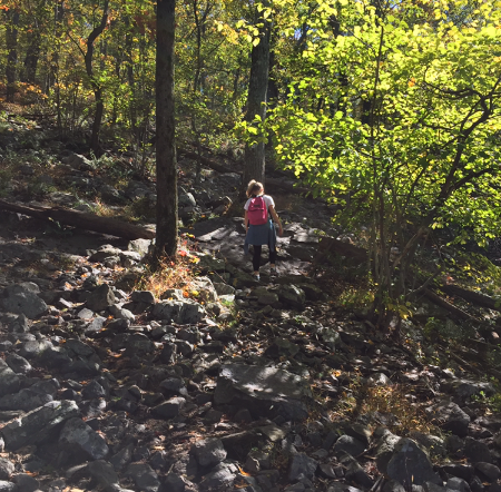
The top of Mt. Tammany is about 1.5 miles from the start of the trail and it gives you a view of the entire Gap, Route 80, and Mt. Minsi again. There’s an area that you can climb down to get an even better view but you must be careful. I actually recommend trying to slide down on your backside. There’s no way I would allow a child to do this and I think my own parents would’ve been throwing a fit had they been with me.

Since the top is the end of the trail you can either take it back down or you can switch over to the blue trail. This seemed to be the preferred way back since climbing down the rocks on the red trail would be a little tricky. It’s mostly a lot of woods but you’ll pass a small waterfall and walk over a mini creek. When you’re done with the trail you’ll be at a different parking lot but there’s a trail to the left of the lot that leads back to the one at the start of the trail.
Overall, the hike is about a 3.5 mile loop and took us about 3 hours since we stopped for a while at the top. It’s something I would most definitely like to explore again and was a great way to catch up with my girlfriends while doing something productive!

Comments